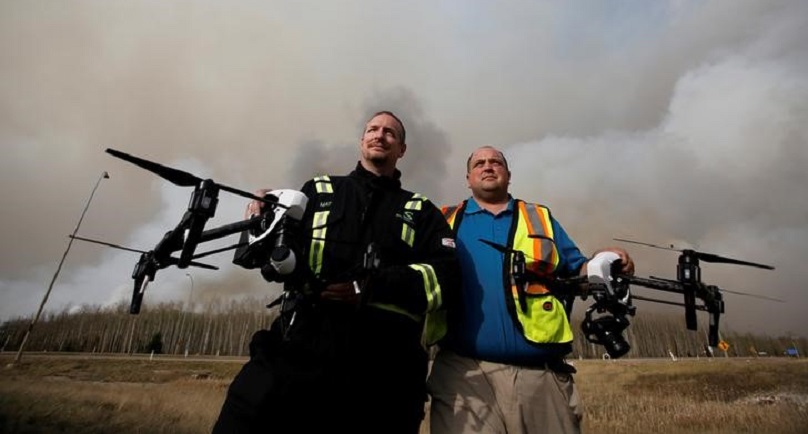
Image: Mat Matthews, operations and safety manager with Elevated Robotic Services, and Ron Windmueller, owner of Droneology, pose with drones as smoke rises from wildfires near Fort McMurray, Alberta, Canada, May 6, 2016. REUTERS/Chris Wattie
![]()
By Rod Nickel
LAC LA BICHE, Alberta (Reuters) – Fire-ravaged Alberta will use drones to investigate the cause of a huge blaze that has scorched the Canadian province and displaced some 88,000 people.
Elevated Robotic Services, which has also deployed drones for mining and construction companies, has contracts with the Alberta government and insurance broker Hub International Ltd, said Mat Matthews, the Edmonton company’s operations and safety manager.
The drones use cameras outfitted with infrared, ultraviolet and traditional optical cameras to pinpoint the hottest part of the fire and trace it to its source based on time, wind and other factors. The cameras will shoot about 800 images, which are then stitched together in a process called fire-mapping.
“It’s like Google Maps but 100 times better,” Matthews said at a police roadblock south of Fort McMurray, Alberta, as smoke from the 156,000-hectare (385,000-acre) fire blackened the sky.
The work begins on Tuesday, coordinated with the other air traffic, including air tankers and helicopters.
An Alberta government official confirmed it had a contract with Elevated. Hub was not immediately available for comment.
The images, if successful, will zero down to a spot on the ground with about a 30-foot (9-meter) radius where the fire is believed to have started. From there, investigators will search on foot for the cause, such as a lightning strike or campfire.
The drones that Elevated will use are manufactured by China’s DJI and sell for $1,900 to $6,500. They are roughly 1 foot wide by 2 feet across, about the same size as those hobbyists use.
Using the more traditional method of gathering images from helicopters, the fire’s cause could be narrowed only to half an acre, a much larger area to search on the ground, said Ron Windmueller, owner of Droneology, which supplies equipment and other services to Elevated.
Downward wind from helicopter blades can disturb the scene, forcing the pilot to stay about 1,000 feet in the air. A drone can capture images from 100 feet.
Even so, drones pose challenges. Because their batteries last only 45 minutes, they will have to land for fresh ones several times for a fire this big, making it more difficult to precisely shoot different parts of the area, Windmueller said.
Still, the flying technology could help get answers quickly.
“If anything,” Matthews said, “(the drones) will allow them to determine a cause much faster.”
(Additional reporting by Matt Scuffham in Toronto; Editing by Lisa Von Ahn)
Copyright 2015 Thomson Reuters. Click for Restrictions.


