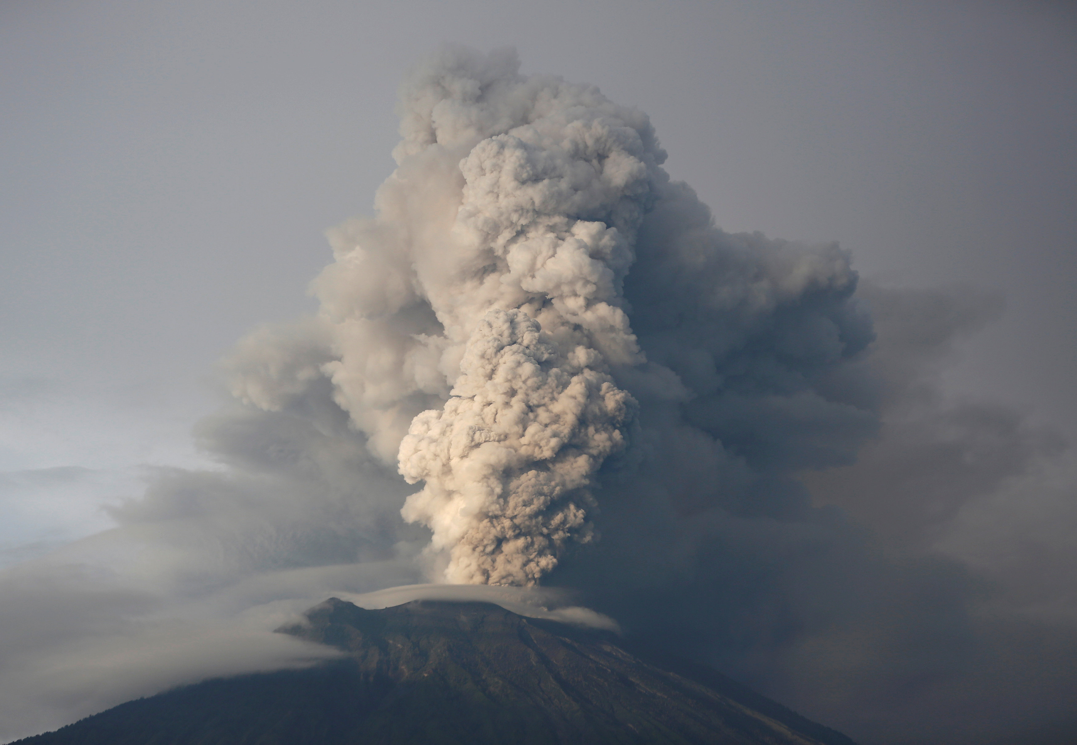
Image: FILE PHOTO: Mount Agung volcano erupts as seen from Kubu, Karangasem Regency, Bali, Indonesia November 28, 2017. REUTERS/Darren Whiteside/File Photo
![]()
By Kanupriya Kapoor
KARANGASEM, Indonesia (Reuters) – The question Indonesian volcanologist Devy Kamil Syahbana gets most is the one he cannot answer – when, or if, rumbling Mount Agung on Bali island will blow up in a major eruption.
The 3,000 meter (9,800 ft) Agung – a so-called strato-volcano capable of very violent eruptions – has recorded a sharp rise in activity that has raised worries about a repeat of a 1963 eruption that killed more than 1,000 people.
“There’s no instrument in the world that can estimate precisely when there will be a major eruption,” said Syahbana, who runs an observatory monitoring the towering volcano, just outside a 10-km exclusion zone.
Sensors beeped and walkie-talkies crackled he spoke to Reuters at the monitoring station.
“People expect certainty but volcanology is a science of probability,” he said pointing to charts showing dramatic fluctuations in the seismic activity deep under Agung.
Authorities raised the alert status to the maximum after the volcano started erupting last month, spewing out ash over the holiday island and causing travel chaos by closing its airport for three days last week.
While hot magma has produced an eerie orange glow just above the crater, and thousands of villagers have fled from their homes on the mountain’s slopes, Agung has, this time, yet to explode violently.
Syahbana, who studied volcanology in Brussels and Paris, said his team’s main job was to “increase the preparedness of the communities here in the event of a major eruption”.
He said safety was his priority, never mind that raising the alert level has spooked residents and tourists alike.
Syahbana said he had not come under any pressure to lower the alert, though his team was “aware of the costs” for Indonesia’s main tourist destination famous for its beaches and temples.
‘NO RECORDS’
Indonesia has nearly 130 active volcanoes, more than any other country.
Syahbana has surveyed and installed instruments on many of the most active ones, including Mount Merapi on Java island, to the west of Bali, and on Mount Sinabung in the north of Sumatra island.
His team of 16 scientists takes six-hour shifts to monitor seismic stations on Agung that record tremors deep inside the mountain, GPS trackers that record changes in land features and CCTV cameras that provide 24-hour surveillance.
“The difference between other volcanoes and Mount Agung is that there are no scientific records about previous eruptions here, only people’s experiences,” Syahbana said.In 1963, pyroclastic flows of lava and rocks poured out of the volcano, killing more than 1,000 people and razing dozens of villages.
According to survivors, that eruption was preceded by earthquakes, volcanic mudflows, and ashfall – all signs that Mount Agung is showing again now, said Syahbana.
COMMUNITY OF EXPERTS
This time, with the internet and live feeds on social media, experts around the world are watching the smouldering Agung.
U.S.-based volcanologist Janine B. Krippner has been closely following since the alert status was first raised to the highest in September, and uses Twitter to share official information and bust myths and hoaxes circulating online. An eruption is “usually a good time for the volcanology community to pull together and share their knowledge”, she said.
“But I’ve never seen it happen on this scale before. It’s partly due to social media and partly because it’s a small and supportive community anyway,” Krippner, who has also remotely monitored eruptions in Iceland, Hawaii and Chile, said by telephone.
With every passing day, and no big eruption, a danger is that a false sense of security creeps in. Syahbana and other experts said everyone has to stay on alert.
“We know this can be a very dangerous eruption,” Krippner said.
“We shouldn’t be complacent.”
(Editing by Ed Davies and Robert Birsel)
Copyright 2017 Thomson Reuters. Click for Restrictions.


