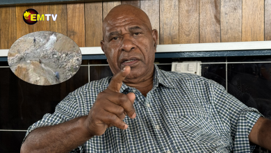
Jimmy Gomoga , the Director of the National Weather Service. File Picture
The country will be experiencing extreme weather conditions in January 2024. This was revealed in an interview with the Director for National Weather Service, Mr. Jimmy Gomoga yesterday, Tuesday 21st of November 2023.
Spring season kicked in over the southern hemisphere on the 13th September 2023 Equinox occurred on the 21st September 2023. Over the last 6 months, wet conditions were experienced over most parts of the country, except over Western, Gulf, Milne Bay Islands & Parts of Highlands region80-200% of average Rain fall (RF) occurred over most parts of the country whilst below 80% occurred over the Western Province and over 200 % over south Fly and Oro.
On the 19th September 2023, El Nino was declared. The sea surface temperature (ssts) have moved towards central Pacific and further warming is expected in the coming months . There will also be reduced rainfall over PNG during the coming wet season.
Last through the coming wet season starting 2023 and into the dry season of 2024 .El Niño typically leads to reduced rainfall right across the country. Strong El Nino events started in March of this year.
In more scientific jargon, El Niño and the Southern Oscillation, also known as ENSO is a periodic fluctuation in sea surface temperature (El Niño) and the air pressure of the overlying atmosphere (Southern Oscillation) across the equatorial Pacific Ocean.
ENSO has reached El Nino threshold and continuing to warm across the Pacific Comparable to 1997 & 2015 ENSO events.
El Nino is finally here. What does that mean for PNG?
- For PNG, El Nino generally means that it will become drier for most parts of the country, however, for the New Guinea Islands, El Nino tends to bring much wetter than usual conditions.
When do we start to see the impacts?
- The likely impacts will not be immediate; it will become evident in the early part of next year. This means that the normal wet season will commence in October/November. However, the wet season for this year will be shortened due to the arrival of the El Nino. This may mean that the real impacts of the El Nino may be felt sometime after March next year.
How strong will the impact of El Nino be?
- For this year, we are expecting two climatic events happening side by side, El Nino and positive Indian Ocean Dipole (IOD). El Nino and a positive IOD are two critical climatic events that greatly influence our climate. Since these events are happening together, they tend to reinforce or amplify the drying influence across the country, resulting in greater impacts. Thus, the impacts are expected to be huge, comparable to the 2015/16 event, or worse as not all El Nino and IOD events are uniform.
What to do now?
- We now have a window of opportunity to prepare and plan for the worst-case scenario, i,e droughts in major parts of the country and frosts occurring in higher-elevated provinces such as Tambul in WHP, Kandep in Enga and Erave and Lialibu in SHP to name a few and more wetter conditions across the NGI regions. Since this is a slow-onset event, it will take at least 10 or more months to impact the country. Our planning must be done with such duration of impact in mind.
All cycles, ENSO, Solar, Drought is already in phase. El Nino has been declared on the 19th September 2023 and will be a strong event.
Rainfall will be below normal/ average across PNG and the coming wet season to be shorter. There is also evidence of Severe Drought onset in Parts of the country which means there is an onset of drought alert
The report also stated that this drought will be a Hydrological one which will affect water sources & reservoirs. The report concludes by urging the Government to be ready for possible drought disaster and prepare and plan for the worst-case scenario
Credits to the PNG National Weather Service


