
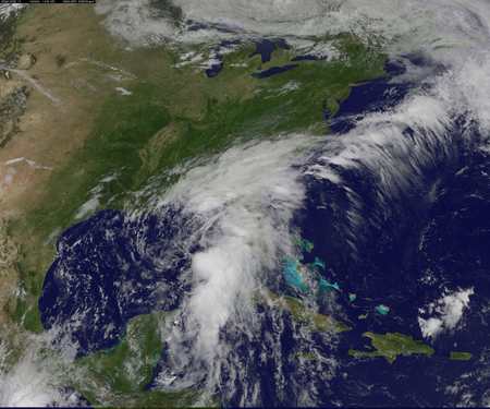
A NASA’s Geostationary Operational Environmental Satellite (GOES) image shows the Tropical Storm Colin over Florida and the U.S. South-East coast in this satellite image released by on June 6, 2016. Courtesy GOES Project Science/NASA/Handout via REUTERS